 |
| Home | Geography | History | Biology | Recreation | News | Resources |
| Timeline | Narrative | Events | Places | People |
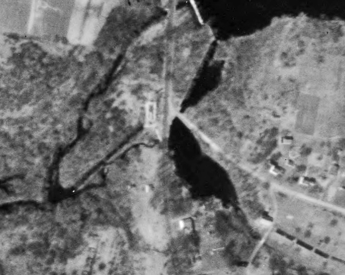
Phoenixville & The Phoenix MillsPhoenixville is one of the small, largely forgotten, mill villages in Vernon. Indeed the only reference to the village name and most of its history is found in "Cascades and Courage," George S. Brookes' 1955 history of Vernon and Rockville. The village includes parts of Phoenix Street and Maple Street. The primary features visible today are the Tankerhoosen Lake, dam and the mill pond. Click on photos for full size images. The Early Mills
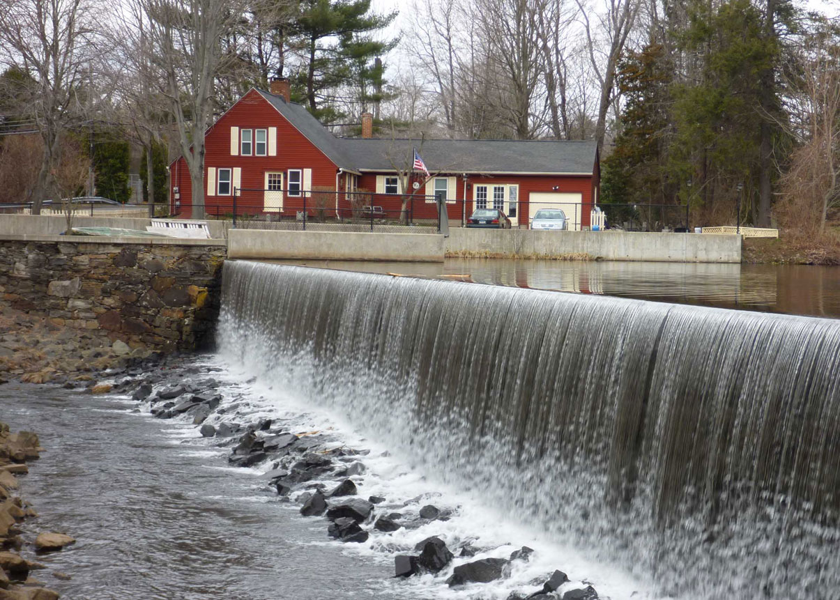
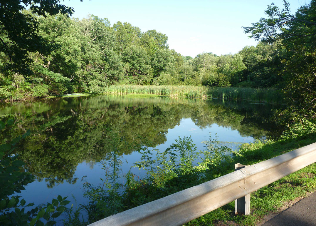
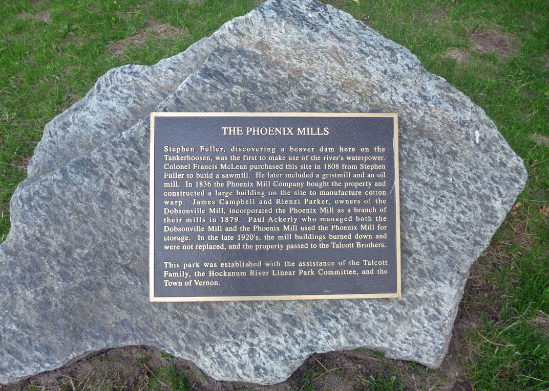
Stephen Fuller, discovering a beaver dam here on the Tankerhoosen, was the first to make use of the river's waterpower. He built a fulling mill on the northwest side of the bridge about 1790. In 1808, the year Vernon incorporated, Francis McLean purchased this site from Fuller and converted the mill to a sawmill, soon adding grist and flaxseed oil mill operations. McLean bought an old grist mill and moved it to this location from the Bolton Road site of the Allis Mills, which McLean had purchased a few years earlier, but found to be uneconomical. The mills were probably located on both sides of the road, north of the river with an open inlet from the origianl dam. For a time they co-existed with the Phoenix Cotton Mill. They and the race are shown on the 1853 Woodward map and also seem to show on the 1857 and 1869 maps. The 2009 Raber study indicates the saw and grist mill, limited to one small building by 1909, remained in place until sometime after 1934. There may still be evidence of the old headrace buried under later construction. Tankerhoosen LakeTankerhoosen Lake is in a narrow section of the valley which make it ideal for damming. As mentioned the beavers found it first and the Indians may have used it as a crossing point. Stephen Fuller probably built the first dam for his fulling mill around 1790. The dam dates to 1830 and there seem to have been mills on both sides of the river. The Phoenix Mills Company bought the mills in 1837 and by 1846 had completed the present 11 acre lake. The dam itself is 128-feet ling, 120foot high stone spillway. In the 1938 hurricane the dam was breached damaging the bridge. At that point the bridge was a 15-foot wide, probably timber structure with a 25-foot span. The bridge was re constructed in 1940 as a single span, reinforced concrete abutment. The width was 28-feet with a span of 18 feet over the river. The current bridge was built in 2012. The railroad to Rockville was built in 186?. A spur was built along the north side of Tankerhoosen Lake to access the cotton mill. When no longer needed the track bed became road that allowed development. By the 1934 aerial photo home and cottages dot both sides of the road, now called Tankerhoosen Road. At the time Phoenix Street still connected to Hartford Turnpike providing easy access to the lake. A 1909 map shows the railroad siding and a large Ice House on the north shore. Also shown is the mill on the northwest corner of the bridge and river. Most of the north shore was owned by Joseph Boardman. The cottage community had a reputation as a lively summer spot with swimming, boating and fishing avaiable.The Cotton MillMcLean sold the mills to WILLIAM BAKER and HARVEY W. MINER, and in 1836 they sold to a company known as the Phoenix Mills Company, who built the largest of the buildings about 1836 manufacturing cotton warp. One of the company directors was LEBBEUS BISSEL, whose family would later own the land that would become the Tankerhoosen Wildlife Management Area.
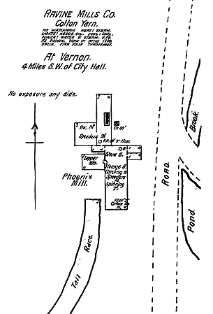
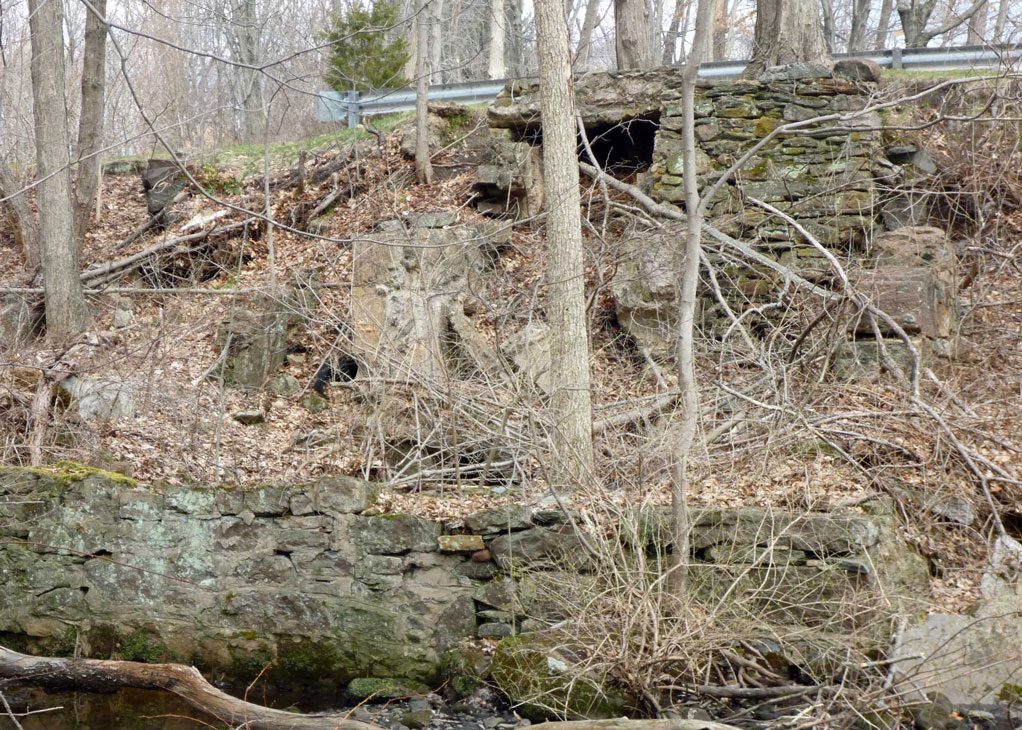
JAMES CAMPBELL (Campbell Avenue) and RIENZI PARKER, owners of the Dobsonville Mill, incorporated the Phoenix Mill as a branch of the Ravine Mills Company in 1879 and produced seine twine in the mill. PAUL ACKERLY, who later managed both the Dobsonville Mill and the Phoenix Mill, used the Phoenix Mill for storage. The 1921 Sanford diagram notes this location is outside the corporate limits suggesting that the property was sold. In July, 1926 the TALCOTT BROTHERS COMPANY bought the Phoenix Mill, Vernon Woolen Mill and the Ravine Mill from Ackerly. In the late 1920's, the mill buildings burned down and were not replaced. Remains of the walls are visible if you peer over the bank. Description
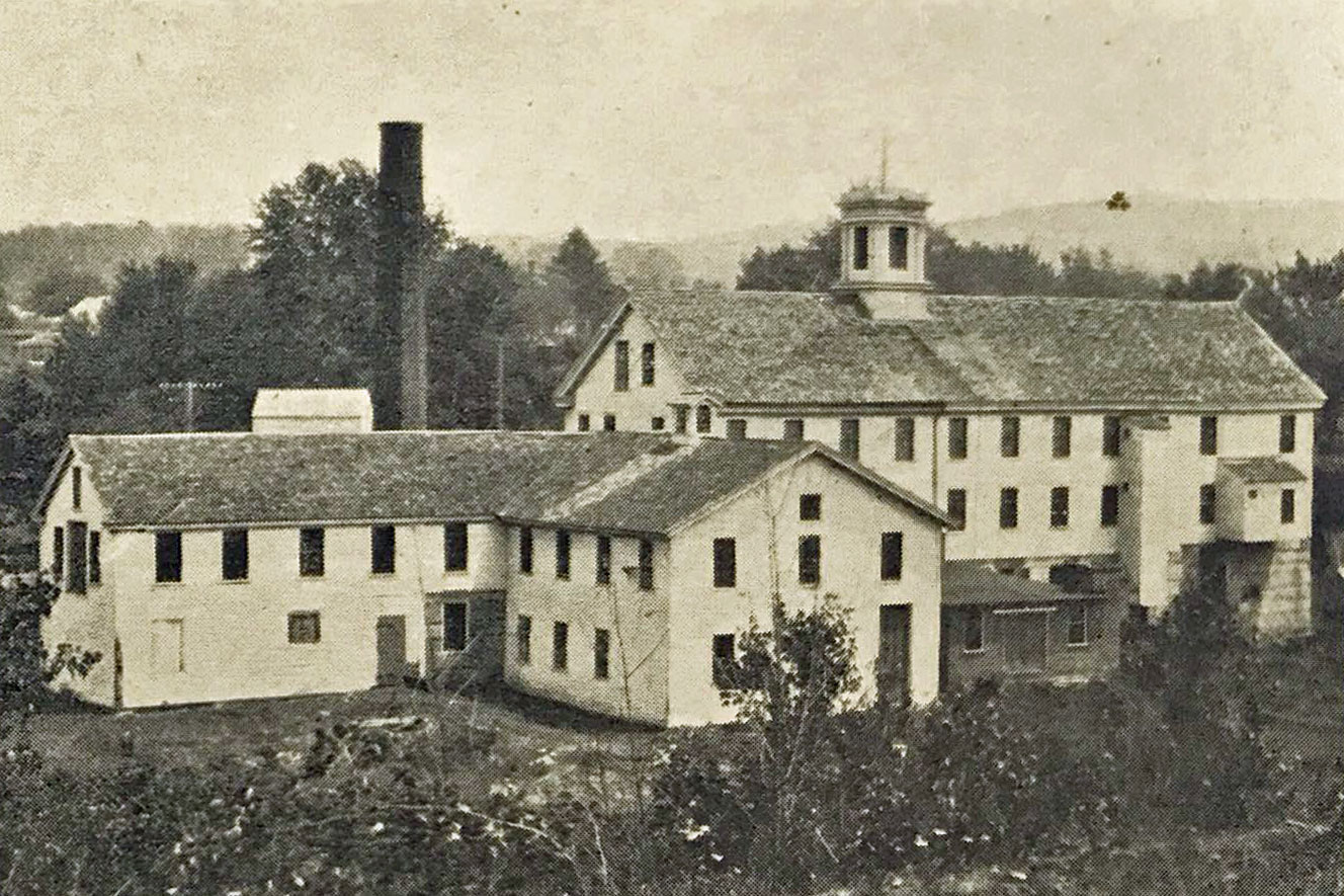
The 1883 "Historical and Industrial Review" provides the following description: The dimensions of the mill are 110 x 35 feet, three stories and attic, and two L's, 50 x 40 and 80 x 20 respectively, each two stories. The basement of the whole is of stone, the upper stories being of wood; and 25 people are employed. The fall of water at this power is 18 feet. A Risdon turbine wheel is used, supplemented by a forty-horse power engine.
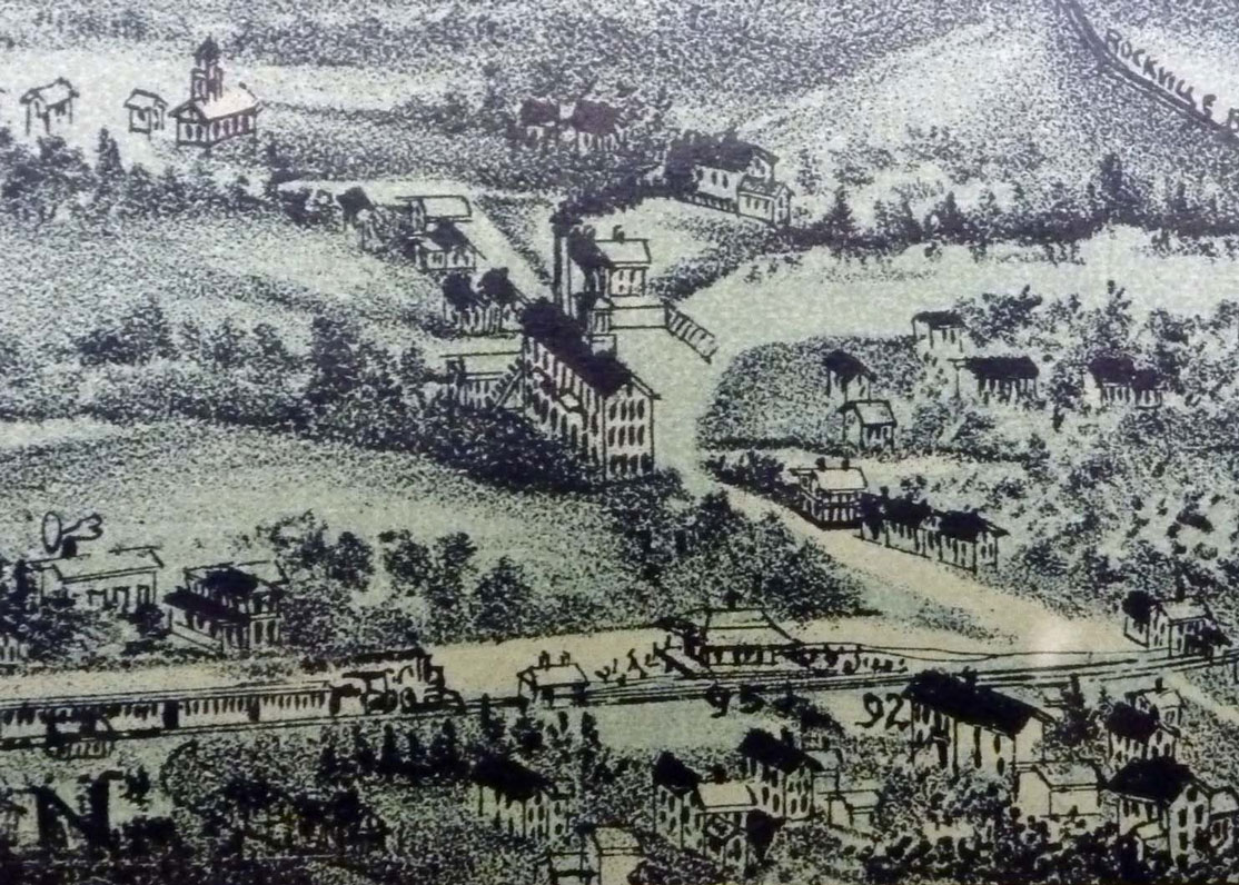
The rear photo of the mill is consistent with the inset on the O. H. Bailey & Co. 1895 Rockville Map. It shows a typical 2-story brick factory with a bell tower. Factory bells were an essential part of every village as they regulated the day calling employees to work. This bell was made by Doolittle, a Hartford company, upon which was inscribed the date, 1840. In 1922 Paul Ackerley built the Lucinda Chapel at Grove Hill Cemetery in Rockville in memory of his mother-in-law Mrs. E. Stevens Henry. The Phoenix Mill bell now hangs in that chapel. A layout of the mill is included in the Sanborn insurance maps of 1897, 1903, 1911 and 1921. At that time the company was the Ravine Mills Company and the Phoenix Mill produced cotton yarn. The layout shows a number of wings. The 1897 drawing notes speeders, a lapper room, carding and spinning rooms. The top note says: "No watchman. Heat: Steam. Lights: Kerosene oil. Fuel: Coal. Power: Water and steam. V.P's as shown. Tank in attic 1200 gallons. Fire pails throughout." The 1903 and 1911 drawings are similar, but add location of loading and storage sheds and that there are two floors for production. In 1921 it notes that the building was used only for storage and is called the Paul Ackerly Upper Mill. Both the 1911 and 1921 maps refer to it as a Paul Ackerly Mill. When Phoenixville was a thriving village Phoenix Street connected the railroad at Vernon Depot with Hartford Turnpike just opposite the present Vernon Diner. Until recently the right-of-way was visible from Route 30, but was lost to the Dunkin Donuts Plaza. Campbell Avenue was a dirt road used by workers traveling to the Dobsonville Mill. Remaining Traces Of Phoenixville
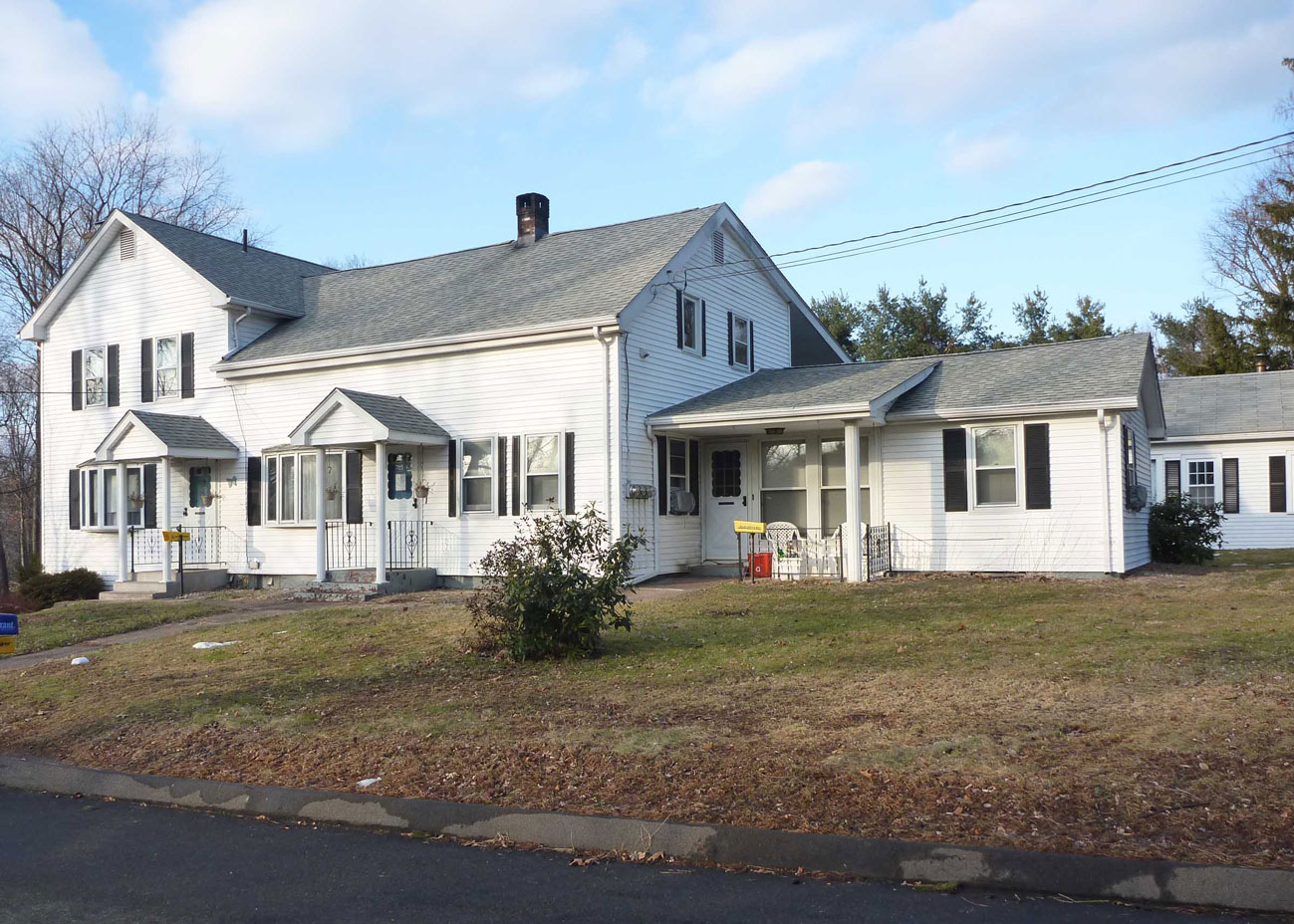
Villages of the time were self contained with worker and supervisor housing provided by the company. There are still several houses dating to that period on Phoenix and Maple Streets. The South School District's schoolhouse was up the hill on Phoenix at the junction with Church Street. A 1934 aerial photo provides one of the best glimpses of what the area once looked like. Although the mill is gone the foundation at the intersection of Maple Street is clearly visible giving an approximation of the mill's size. Also visible is the channel that carried water from the lake to the mill by way of a small pond where the town parking lot is now located. It flowed under Maple Street and into the Ackerly Pond before dropping into the mill over a second dam. This channel is clearly shown in photos and maps up into the 1950's. There would have been a sluice or gate at the dam to control the water flow. Ackerly Pond is fed by Tillinghast Brook and was created for the mill. It is rapidly filling with sediment getting smaller each year. It is still popular with wildlife as you may see ducks, geese, beaver or blue herons in the water.
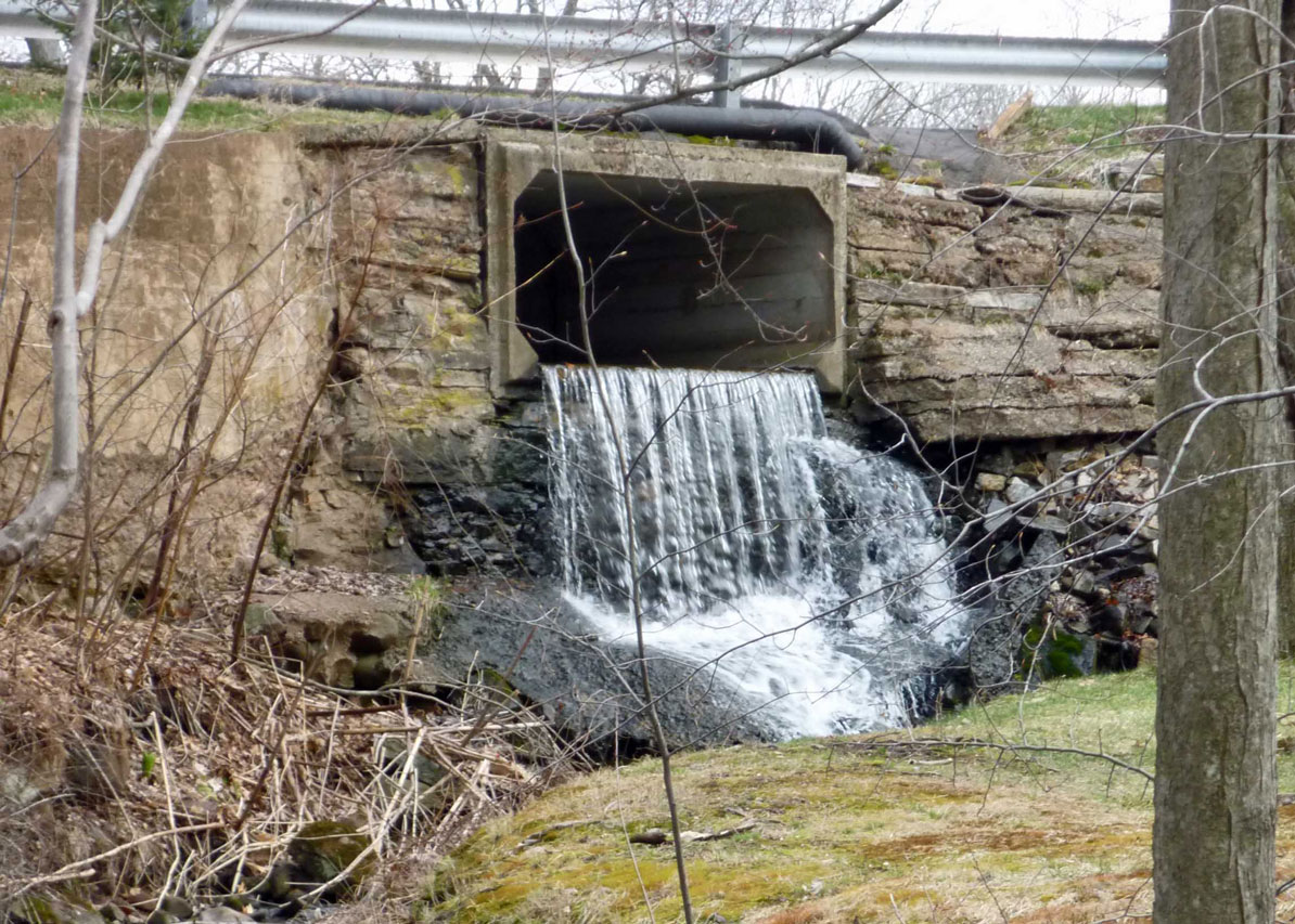
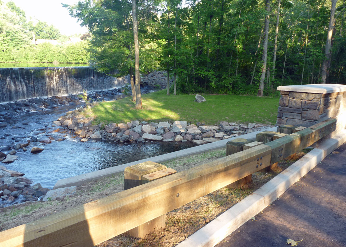
The Area TodayThe primary feature of the area today is the Tankerhoosen Lake dam, the only dam in the Tankerhoosen Valley visible from the street and arguably the most scenic. For those who like statistics Tankerhoosen Lake is the largest in the Tankerhoosen Valley with a normal surface area of 16.5 acres, draining an area of nearly 11 square miles and is owned by the DEEP. The dam is masonry, of earthen construction with a height is 16 feet and a length of 237 feet.
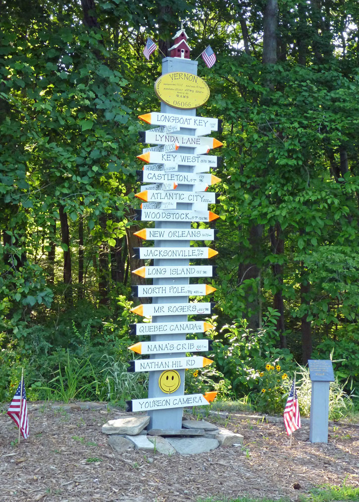
Near the dam and lake is a small park owned by the town of Vernon. Below the dam the park contains an historical marker with the area's history. Above the dam and next to the lake are benches. It's a good place to teach children how to fish. The circa 1940 bridge over the Tankerhoosen River was replaced at a cost of $1.1 million with a new bridge opening in July 2012. The stone design of the new bridge nicely complements the area. The mill pond still exists and is today part marsh, frequented by ducks, geese and an occasional egret. The channel from lake to pond is now a parking lot. West of Phoenix Street and down the bank are remains of the mill including old walls and water channels. Nearby is another unique feature - a homemade direction sign and fancy birdhouses built by neighbors Bill and Dave. The current residents of what was once Phoenixville take pride in the area helping to maintain the park and beauty of the area. OtherLocal papers provide a glimpse of mill life. From a 1913 Rockville Journal column: "Mr Houle and family have moved from Andover into one of the Ackerly tenements in Phoenixville. Mr. Houle has entered the employ of Paul Ackerly." "Paul Ackerly's auto truck, which was badly damaged by accidentally catching fire last fall, has been completely rebuilt and is in commission again." "Joseph McCrystal, who had his left hand caught in the gears while attempting to open the water gate at the Phoenix Mill pond last Thursday evening, had to have one joint of one finger amputated. Two other fingers were badly lacerated and bruised." Sources(2009). Cultural Resources Reconnaissance for Replacement of Phoenix St. Bridge over the Tankerhoosen River by Michael S. Raber. Historical and archeological review of the area. "Cascades and Courage" by George S. Brooks, 1955, 529 pages. This is the classic local history book. The entire text can be found and searched online. Scott Lent's Vernon Depot, Dobsonville and Mills website. (1883). The Historical Statistical and Industrial Review of the State of Connecticut, Part I. W. S. Webb & Co. Detail review of businesses including mills. The link is just to the Vernon and Rockville section. Page 264 has a description of the Phoenix mill. FindLakes.com - Information on CT lakes. Updated February 2021
| ||
Home | Activities | News | References | Search | Site Map | Contact Us © Copyright The Tankerhoosen. All rights reserved. |