 |
| Home | Geography | History | Biology | Recreation | News | Resources |
| Timeline | Narrative | Events | Places | People |
Southeast District - Valley Falls SchoolRecords indicate there was an elementary school at Valley Falls. Brookes in "Cascades and Courage" mentions Valley Falls as one of the earliest schoolhouses. We know little about this schoolhouse, long out of memory, but can make a few educated guesses.
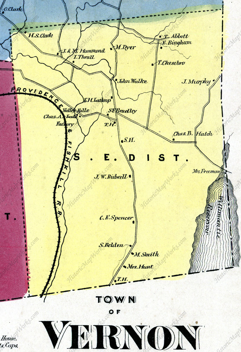
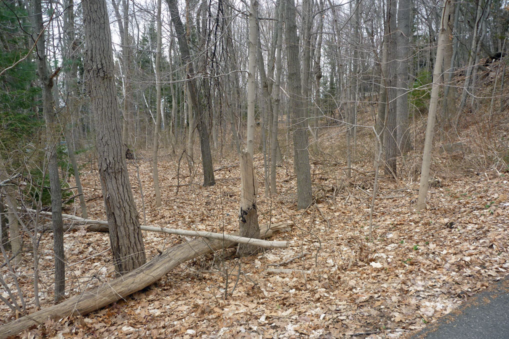
Early in the town's history Vernon was divided into nine districts so that school would be available within walking distance for every child from 4 to 16. These were elementary schools teaching basic skills and knowledge to children. The Southeast District school was located on Bolton Road close to the exact center of the district. Another factor that might have determined the location of the schoolhouse was the water source, a spring at the top of the mountain that was used for a distillery around 1800 and later would provide water for the Beach Family and Valley Falls Farm. We aren't certain when the school house was build but an 1803 deed transferring property within the Walker Family on the East side of Bolton Road uses 'the school house' as a reference point. Reverend Ebenezer Kellogg in his description of 1800 Vernon says there were six school houses at that time. Although he does not list the schools it would likely have included the Valley Falls school. There was, however, a small population in this area. The first sawmill at Valley Falls was in operation in 1740 as was the Allis Mills. Over the years there were a succession of mills in this section of town producing grist, flaxseed oil and cotton until the last mill was destroyed by fire in 1877. Otherwise the population was made up of farm families. On May 2, 1843 the Southeast School District purchased a small triangular piece of land on Bolton Road from Albert G. Dart for $10. The school was already on the lot. See the property description under Sources. The 1853 and 1869 maps of Vernon show the nine school districts and the location of their schools. The Southeast District school is shown on both maps on the east side of Bolton Road a short distance south of the intersection with Valley Falls Road. These are the only maps that locate the school. The maps indicate the school was at a slight bend in Bolton Road. The east side of Bolton Road is steep, part of the eastern wall of Railroad Brook, not a great location for a school near the road. There is a flat spot at the bend in the road at 534 Bolton Road. It appears gravel may have been removed from the hillside, perhaps to build or shore up Bolton Road. It left a level lot large enough for a small school. There are a number of stones on the lot, but nothing that would prove a school was there. The trees present today are secondary growth, none likely older than 1880.
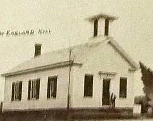
For an indication of the children who attended the Southeast school we have a report from 1848 listing students and their parents, guardians or employers on September 1 of that year. Formal reports to the town were required of all schools to receive funding from the state. Supervision of schools was the responsibility of district parents with oversight by a town School Society. The report lists 33 children between 4 and 16 living in the district at the time, but that only 27 attended school. The family names in the report compare well with the property owners on the 1853 map. Most live on today's Bolton Road extending from Clark Brook not far from I-84 to the Bolton town line. Familiar names include, from north to south along Bolton Road: Edgar Edgerton, Josiah Hammond, Ira Thrall, John Walker, Anson Lyman, Arial Sparks, Augustus Kneeland, Julius Strong, and Martin Smith. Considering the hill involved many of the students had a challenging walk each day. Brookes says that in January 1870 the number of students between ages 4 and 16 in the Southeast District was 26. In 1878 the number was 23. The 1902 Selectman report shows it has declined to 14 and the town is wondering whether to keep it open beyond the next year. This tells us that the number of students was probably never very large and that the school was still in use in 1902. Recall that the last mill burned in 1877 so it was likely that mill workers were moving to Rockville to find work, further reducing the population. There are no sketches or photos of the Southeast School, but a composite 1895 photo shows schools existing at that time. Several share a similar design so we might guess the small, likely one room, Southeast School would be similar. From the 1843 property description a fence ran along the road in front of the school. Vernon sent a committee to visit and inspect each school annually. The 1902 report for the Southeast District says, "So afar as the school is concerned here both in teacher and management we have no fault to find, the building is comfortable and in fair condition. The school was good but the attendance was very small. The joint board have thought best to appropriate the same amount of money for another year hoping that the attendance may be increased." The teacher that year was Gertrude Herskell. An Era EndsAfter the Valley Falls Factory closed in 1877 the school age population dwindled such that each year for almost twenty years the School Committee wondered whether it was time to close the school. There seemed to have been just enough students to justify the one teacher. Finally it was taken out of their hands and the end came suddenly in 1911. Fire Destroys School Building in Southeast District The Southeast district school building in Vernon, located on the Bolton Road, was totally destroyed by fire Saturday night (January 28). The fire started about 8 o'clock. There was a heavy wind, and although several people were promptly at the scene of the fire, the building was in ruins in a short time. The origin of the fires is unknown. The building, which was a frame one, was insured for $300 through the agency of Arthur T. Bissell of this city. There has been no school in the Southeast district schoolhouse for several years, the scholars in the district being conveyed to this city, where they attended the East District school.
For the next few years the School Committee considered rebuilding the school in the Southeast District but in their 1913 report wrote, "Ever since the school house in this district was destroyed by fire several years ago, the plan of transporting the pupils to the East District has been followed. Results have been so satisfactory that there is no thought of rebuilding." In 1914 the town voted to consolidate several of its school districts and to assume control from the School Committees. On December 20, 1916 the Southeast School District property on Bolton Road was transferred to the Town of Vernon. The Quit-Claim Deed describes the property as "bounded on the northerly, easterly and southerly sides by land of Allen R Lathrop, and on the westerly side by the highway leading from Vernon Center to Bolton." The property likely became part of the Beach estate soon after and returned to woods. The Beaches began buying property in 1915 and in 1917 bought 103 acres on Bolton Road from James Bidwell. In 1958 Charles Beach sold the last 225 acres to Jones and Lyons, real estate developers from Old Lyme, CT. In 1974 Lee & Lamont Realty subdivided the property and a series of homes were built on the hillside east of Bolton Road. After a hundred years there is little to show there was ever a school on Bolton Road. Perhaps one day archeology work will be done to see what remains. One piece of the school remains. According to the Darico family, who lived in the Valley Falls Farmhouse, their front step was removed from the old schoolhouse after the fire and is now the farmhouse step. Sources"Cascades and Courage" by George S. Brooks, 1955, 529 pages. This is the classic local history book. It contains a chapter on education and is the basis for this article. The entire text can be found and searched online. 1803 Bolton Land Records, Vol. 8, p. 399, Norman Walker to John Walker, Jr mentions the School House as a boundary reference. 1843 Vernon Land Records, Vol. 3, p. 464, description of the property, "A certain piece of land situated in Vernon aforesaid described as follows, beginning at the heap of stone in the turn of the fence about two rods north of the school house in said District, hence running Easterly as the fence now stands about three rods to stones, thence Southerly as the fence now stands about thirteen rods to the highway containing about nineteen rods of land ??? the same more or less, being the same land which is now thereon out?? for a school house lot in said District." Note: 1 rod = 5.5 yards or 16.5 feet so the property was a triangle about 50' x 215' on a curve with the road as the third side. The area was 19 square rods or 5,172 square feet or .12 acres. Not much larger than the school itself. 1848 Southeast District School Report - On file at the Vernon Historical Society, Box 86-E Early School Records. Updated March 2021 |
Home | Activities | News | References | Search | Site Map | Contact Us © Copyright The Tankerhoosen. All rights reserved. |